Basics
Home and SearchSite Guide
Brentford Basics
Privacy Policy
Contact
People
FamiliesPhotos of people
Name indexes incl WW1
Memories
Lists, Documents, News
Occupations
Properties
Properties: High StreetProperties: non-High Street
Photos
Maps
1909/10 Valuation Index
Pub Hub
Can You Help?
Seeking...Mystery photos
Roads Off
A-Z listJanet's Research
HistoryBeach's Jam
Nowell Parr
Turner the Artist
Queen Victoria 1840
Brentford Market
80 High Street
Clitherow of Boston House
Four Croxford Brothers
Sources & More
They SaidBooks etc.
Web Links
Next
Site Technology
Author
Home and Search
Not Brentford
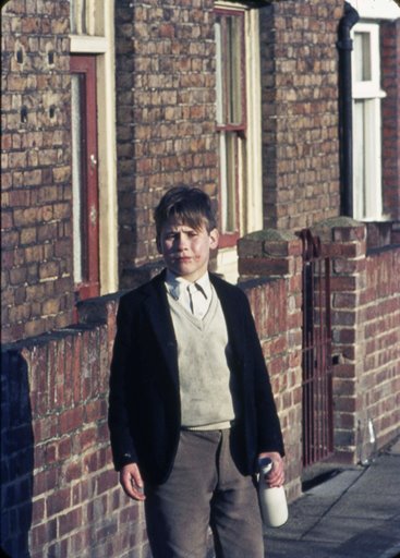
Layton Road Kid, 1973
| Peter Young took this photo on 16th January 1973; nowadays it would be called a candid photo.
Layton Road is on the northern side of the railway between Brentford and Kew Bridge stations, joining Windmill Road and Ealing Road. By 2020 the western end had been redeveloped and a dis-joint near Brook Road North means it cannot be driven along, end to end. The 1925 map shows Layton Road in its original form. This area was on the outskirts of Brentford in the mid-19th century and Layton Road was built up in stages. The western end, up to Brook Road North, had around 14 semi-detached homes by 1894 on the northern side and a spattering of buildings on the southern side. By 1912 the 25" to the mile OS map shows an increase in the number of rail tracks, which presumably limited the scope for developing Layton Road's southern side, and since 1894 23 terraced properties had been built on the northern side between Brook Road North and Ealing Road. The road may have been named after Thomas Layton, although he died in 1911, some decades after Layton Road is marked on the OS map. The photo looks eastwards along the road. |
 |
Published July 2020